Revised: Underway Again #17: Long Island
 |
| Caribbean side |

 |
| Atlantic side |
We arrived in Thompson Bay, Long Island by 2:00 p.m. and went ashore
to explore.
Long Island, crossed by the
Tropic of Cancer, is 160 miles southeast of Nassau. Although 80 miles long it
is only 4 miles at its widest point.
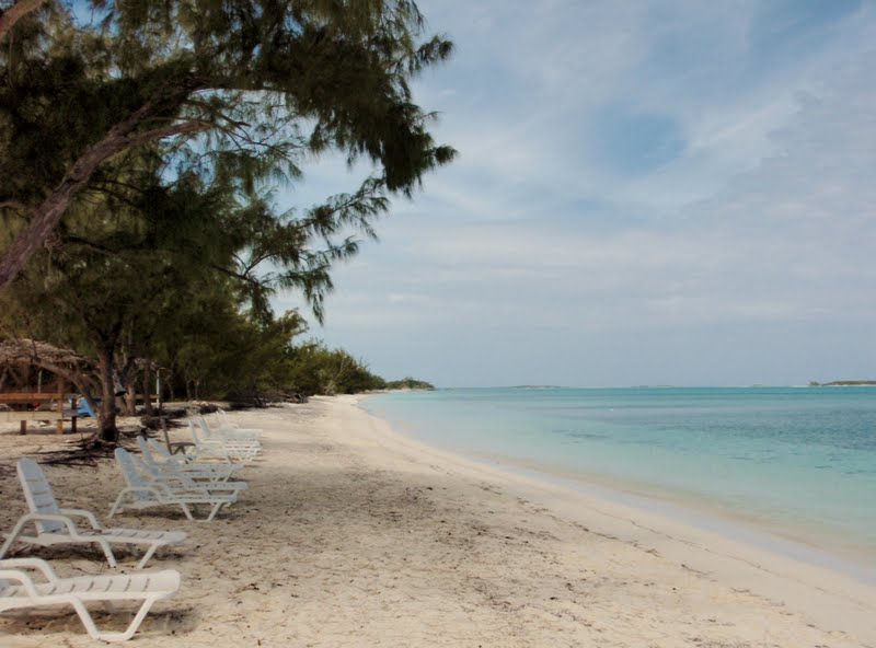
While exploring, we trekked over to the Atlantic side to see a beach
that someone had told Melinda about. The Atlantic coast is steep, rocky with
countless coves and rolling waves while the Caribbean side features beautiful
tranquil bays and white sandy beaches.
The contrast is very interesting and we are in awe of the beauty
surrounding us.
Originally called Yuma by the Lucayan Indians, Long Island
was rechristened Fernandina by Christopher Columbus when he first set foot upon
in 1492. It is heralded as the most scenic of all the islands in The
Bahamas.
In fact Christopher Columbus
recorded it in his ship's log as "the most beautiful island in the
world".
With a population of 3500,
we found the people to be genuinely warm and friendly and it is a place to
which we plan to return.
On one of the days we rented a 24 hour van for all 6 of us to tour the island starting at noon the first day.
We decided to tour the southern part of the island the first day and our first stop was at Hamilton's Cave.
 |
| Going into the cave |
 |
With our guide in one of the chambers.
|

Hamilton's Cave is the largest cave system in the Bahamas with giant stalactites and stalagmites and intricate passages some of which have yet to be explored.
 |
| Can you see the face carved into the rock? It looks like a gorilla is carrying the head. |
 |
| Some very unusual formations, completely natural. |
 |
| Bats,Bats,Bats |
Our guide was Leonard Cartwright whose family has lived on the island for generations and who has actually purchased the land in which the caves sit from the government.
He takes great care of and great pride in the caves and gave us a wonderful tour of the caves.
This was once home to the Lucayan Indians before the coming of the Spaniards.
We went from one room to another and once we even had to crawl from one cavern to another.
The natural formations were awesome and sometimes quite amusing.
Several different varieties of bats live in the caves but fortunately they stayed on the ceilings of the cave and did not come flying down.
 |
| Artifacts found |
Only one road, the Queen's Highway going north to south, is paved. All other roads are rocks and packed dirt. It took us 3/4 of an hour over a very bumpy road to cover the short distance to Dean's Blue Hole.
A Blue Hole is a dark blue spot in the
middle of turquoise water.
The darker
the blue, the deeper the water.
This
particular hole is 660 feet deep and when divers first explored this hole in
1992, they discovered that this blue hole opened up into a vast, over 4,000
foot, underwater cavern ranking it as the largest yet discovered in the world.

There is a plaque commemorating the death of two women and
a child all on the same day just a few years ago.
We found out later that a Bahamian family had come to see the
Blue Hole.
The young girl wandered too
close to the edge and fell in.
First,
her mother jumped in to save her and then the mother's sister.
Unfortunately and surprisingly, many
Bahamians cannot swim.
All three
drowned.
From there we continued to Clarence Town, the island's
capital, whose notable landmarks are two white churches situated on opposite
hills.
They were built by John Hawes,
known as Father Jerome, an Anglican minister-architect, who converted to
Catholicism.
The older church, St.
Paul's, is Anglican while St Peter's (blue) is Catholic.
Father Jerome built the Hermitage on Cat Island which I described
in our last trip.
We stopped at Rowdy Boys for a drink and I had a Bellini,
which I really enjoyed, for the first time. We had heard about Little Harbour a
a beautiful anchoring spot. As it was on
the Atlantic side, we decided to drive out to see it.

The road was quite passable at the beginning, but soon we could
go no further by car.
We figured it
could not be far and decided to walk it.
An hour later the good news was that we finally got to see Little
Harbour but the bad news was that now we had to walk back.
Roman's back is bothering him so much that
he is taking muscle relaxants and pain medication without a struggle.
He could barely walk by the time we got back
to the car.
We made it back to Salt Pond
(Thompson) where we went to dinner at Long Island Breeze Resort which has a
dining room on the second floor overlooking the bay.
Tired but happy we dinghied back to our boats.
 |
| Taking a picture of our boat in Thompson Bay. |
 |
| Which is our boat? |
 |
|
People are buried above ground in cemeteries adjacent to their church. |
The next morning we went north to
the
 |
| Can you see our van at the top? |
Columbus Monument high on Cape Santa Maria Cape.
The monument is on government land and meticulously
maintained.
Unfortunately the roads are
private and there is little incentive to maintain a road that is rarely
used.
We found out later that most
tourists are brought in by boat to see the monument.
We bumped along the road until there were large holes that we
just could not go around.
It looked as
if the rocks had been just thrown around, most likely the result of a
hurricane.
 |
| You can see the monument on top of hill. |
We decided it had to be just around the bend and decided to walk the rest of the way. It turned out to be a 1.7 mile hike one way up and down the hills but the view was breathtaking when we finally got there.
Ironically the monument is dedicated to the peace-loving Lucayans and to Columbus.
Ironic because it only took 25 years for the Spaniards to wipe out all of peaceful Indians either with disease or by using them as slaves in Hispaniola (Haiti and Dominican Republic) and Cuba.
 |
View from the monument.
If you look carefully, you can see the road we had to hike to get to there. |

After we travelled to the Canadian owned Cape Santa Maria Beach Resort which is a 4-5 star resort with one of the 10 most beautiful beaches in the world.
It is located on Calabash Bay and we decided our next anchorage would be Calabash Bay.
We next went to the most northerly part of the island accessible by road. Here we could see the power of hurricanes. This bridge, at one time, led to the continuance of the road.
If you look closely at the picture of the three if us, you will see large parts of the bridge in the foreground in the water.
 |
| A salt pond |
On the way back we went past the Stella Maris Resort and back to Salt Pond as we had to return the car by 12:00 noon.
We did some grocery shopping, went back to our boats and later met at Long Island Breeze Resort for drinks and a few games of Mexican dominoes.
We fondly and sadly said goodbye to Melinda and Harry who are going to travel south to the Caribbean while Bill, Maureen, Roman and I will travel north to Calabash Bay. We will miss Melinda's enthusiasm and Harry's sense of humour as well as their dominos and wish them fair winds and seas.


 There is a plaque commemorating the death of two women and
a child all on the same day just a few years ago. We found out later that a Bahamian family had come to see the
Blue Hole. The young girl wandered too
close to the edge and fell in. First,
her mother jumped in to save her and then the mother's sister. Unfortunately and surprisingly, many
Bahamians cannot swim. All three
drowned.

 The road was quite passable at the beginning, but soon we could
go no further by car. We figured it
could not be far and decided to walk it.
An hour later the good news was that we finally got to see Little
Harbour but the bad news was that now we had to walk back. Roman's back is bothering him so much that
he is taking muscle relaxants and pain medication without a struggle. He could barely walk by the time we got back
to the car.


 After we travelled to the Canadian owned Cape Santa Maria Beach Resort which is a 4-5 star resort with one of the 10 most beautiful beaches in the world. It is located on Calabash Bay and we decided our next anchorage would be Calabash Bay.